July 25: At Sea Sailing towards Norway

Oil Platform in the North Sea

Oil Platform in the North Sea

Today is another day at sea.  This morning there was fog, with the steady drone of the ship’s foghorn.  Now the fog has lifted to low clouds and it is quiet.  The sea is calm.

In the morning we went to hear Location Guide Barbara give her hints for upcoming ports.  She is very well informed.

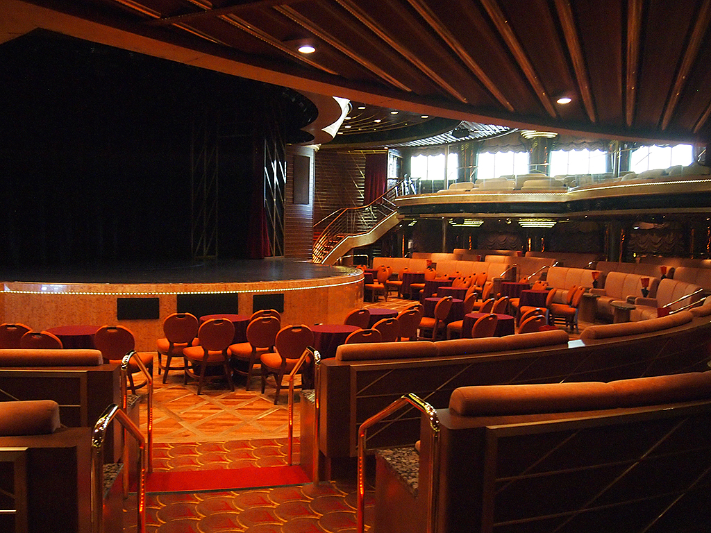
Veendam Showroom at Sea

Veendam Showroom at Sea

After her, there is often a lecture by Captain Eschenfelder, someone whom I first thought was a historian.  This man is actually a recently retired airline captain from Delta Airlines, and is not only well informed about history, but geology, geography, navigation, politics— you name it.

This morning he gave a lecture on modern air travel— very little to do with our cruise, but very interesting.  He used to captain an Airbus 330.  He compared being an airline pilot twenty or more years ago, with today.  All kinds of details about route planning, GPS, long-range twin engine aircrafts (such as the Airbus 330 and Boeing 777), and the tremendous improvements in engine reliability.

Only 4% of airliner diversions are due to technology issues.  The most frequent cause is not even weather, because they have a better handle on forecasting as well.  It is passengers becoming unwell and needing immediate medical attention.  So, pretty soon, be prepared for your TSA medical exam before boarding an aircraft.

Otherwise, for me, days at sea get old fast. I don’t have the feeling I am on an adventurous trip, but more that I am living in an old age home.

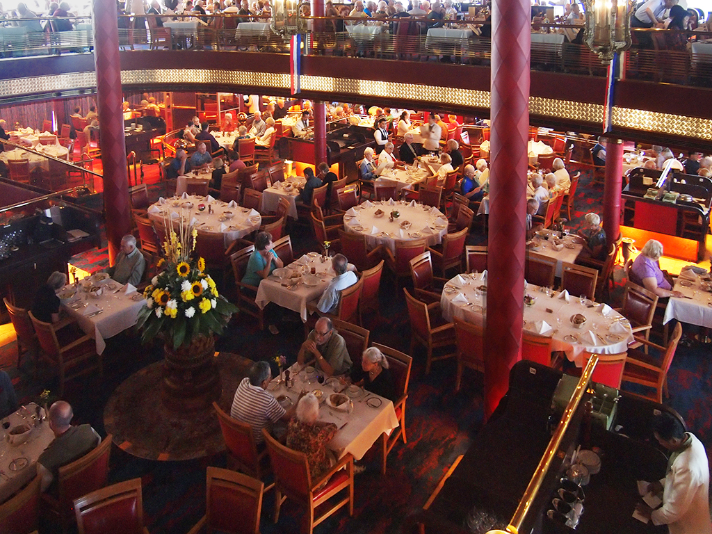
Rotterdam Dining Room

Rotterdam Dining Room

The more interesting July 24 entries by P.J and me were also uploaded today.

Photo © 2014 P.J. Gardner. All rights reserved.

Posted in Blog, Cruise | Comments Off on July 25: At Sea Sailing towards Norway

July 24: Faroe Islands: Where are We?

Early in the morning I got great view of the spectacular north coasts of the Faroe Islands.  I also saw we were heading for a fog bank further south.  As we dove into the fog and the ship sounded its fog horn every two minutes, the fog got denser and denser.

First View of the Faroe Islands (by Arjan Post)

First View of the Faroe Islands (by Arjan Post)

Around the time we were supposed to arrive in Tórshavn, the capital of the Faroe Islands (part of Denmark), and the ship gradually slowed down more and more, all of a sudden the ghostly appearance of a big tower came up out of the fog very close to the ship!  At first I thought it was a lighthouse, but it was a huge crane on our dock.  We were almost docked and we still had not seen anything!  Good navigating!

Norwegian Royal Yacht in Tórshavn Harbor (by Arjan Post)

Norwegian Royal Yacht in Tórshavn Harbor (by Arjan Post)

P.J and I split up again today.  She did a boat excursion to the Vestmanna Seacliffs.  She really enjoyed that and gave you her own account.  She may have made the better choice.

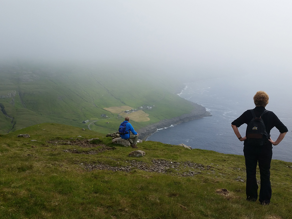
I chose a guided mountain hike on Streymoy Island.  It was labeled “for the physically fit”, so when I saw a few fellow passengers on the bus that looked like they might not be, I was a bit concerned.

View from the Top of the Hike (by Arjan Post)

View from the Top of the Hike (by Arjan Post)

There was a young girl in her twenties who was dressed for a dating bar, not a hike.  It turns out she had twisted her ankle a few days earlier.  The guide advised her not to do the hike, but she was with family and insisted.  All the older participants were real troopers and did just fine.

Hikers Returning (by Arjan Post)

Hikers Returning (by Arjan Post)

But we all had to wait endlessly for this girl, who was limping and in agony the whole walk and had to be helped by a family and staff member.  She also acted resentful that she was put through this ordeal, instead of being grateful to the people that helped her.  I do not know her side of the story.  I did not talk to her, because my only possible question would have been, “What the hell are you doing here?”, and that would have been rude.

Otherwise the hike was wonderful.  We were not as blessed with gorgeous weather as on our day in East Iceland.  Because of mountain fog, our guide had to scrap the original hike he intended for us.  But he knew the island and the weather like the back of his hand and made the bus drive around until he saw a trail that looked like it was free of fog.

Back Country Lake (by Arjan Post)

Back Country Lake (by Arjan Post)

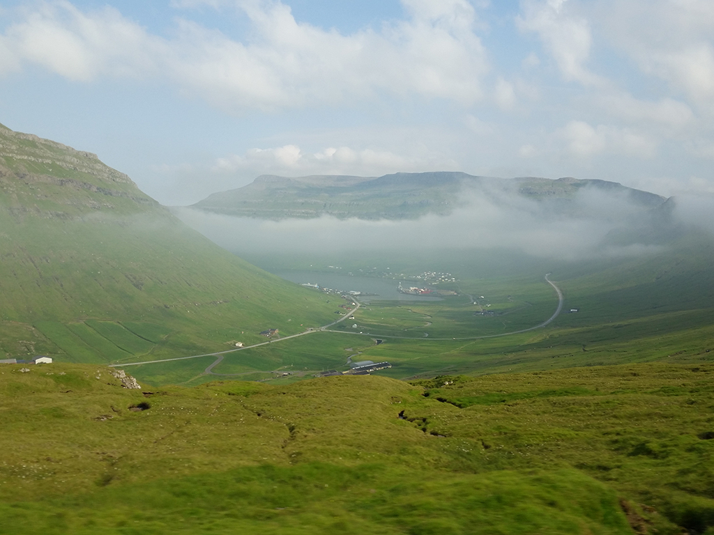
As the day wore on, the fog burned off and lifted in most places.  We were able to enjoy the beautiful vistas the Faroe Islands have to offer.

Kollafjørður Inlet on Streymoy Island (by Arjan Post)

Kollafjørður Inlet on Streymoy Island (by Arjan Post)

I was hiking mostly with the Faroe guide and two other guys because we had a similar pace.  Where were the other two guys from?  One was from Cambridge, Massachusetts, and the other from Jamaica Plain, a Boston city neighborhood.  Remarkable, since I had not met other people from greater Boston before.

P.J and I agree: This is one of the most beautiful places we have ever seen.  It has joined my top two (now top three): Alaska and the South Island of New Zealand.  P.J and I have more or less decided we want to come back here on our own somehow.

Photos © 2014 Arjan Post. All rights reserved.

Posted in Blog, Cruise | Comments Off on July 24: Faroe Islands: Where are We?

July 24: The Beautiful Faroe Islands

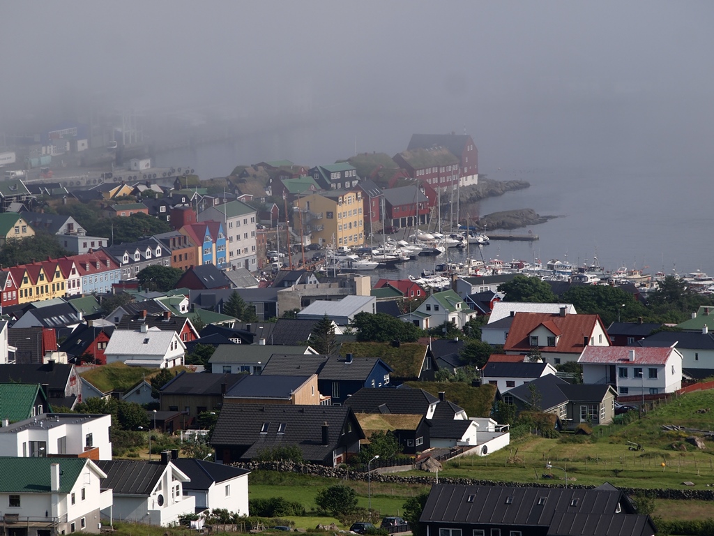
Tórshavn, Faroe Islands, Wrapped in Fog

Tórshavn, Faroe Islands, Wrapped in Fog

Today was my best day yet. The Faroe Islands are one of the most beautiful places I have ever been. Although Tórshavn, the capital, remained enshrouded in fog the entire day, luckily, my chosen excursion to the Vestmanna Seacliffs took us out of the fog bank and exposed us to a small taste of the impressive scenery of this place.

The Faroe Islands is an archipelago of 18 islands, all but one or two of them inhabited.  The overall arrowhead shape is sliced diagonally into parallel strips separated by narrow sounds. The terrain is extremely mountainous, the west side of each of the major islands consisting of high, craggy volcanic cliffs, and the eastern side carved out by deep green fjords.
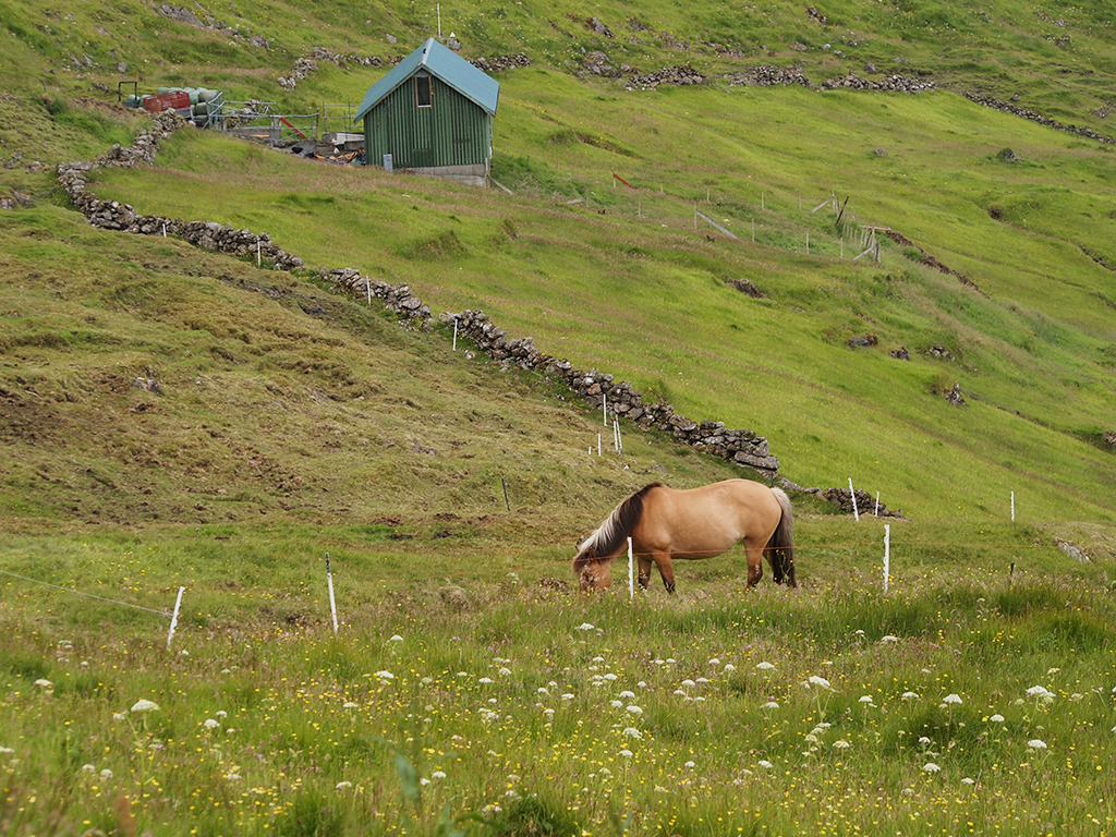
Horse Pasture on the Steep Hillside

Horse Pasture on the Steep Hillside

Our bus ride climbed out of the fog of Tórshavn, ever higher and higher on brand new roads into the bright green, grass-covered steeps of Streymoy, the largest of the Faroe Islands. There are no trees anywhere, and the slopes are ribboned with streambeds (currently waterless from the lack of rain). To conquer the mountainous terrain, the Faroese have built tunnels under the sounds and mountains to make travel easier, and our trip to Vestmanna, at the end of the road on the west side of the island, took us through two of them.
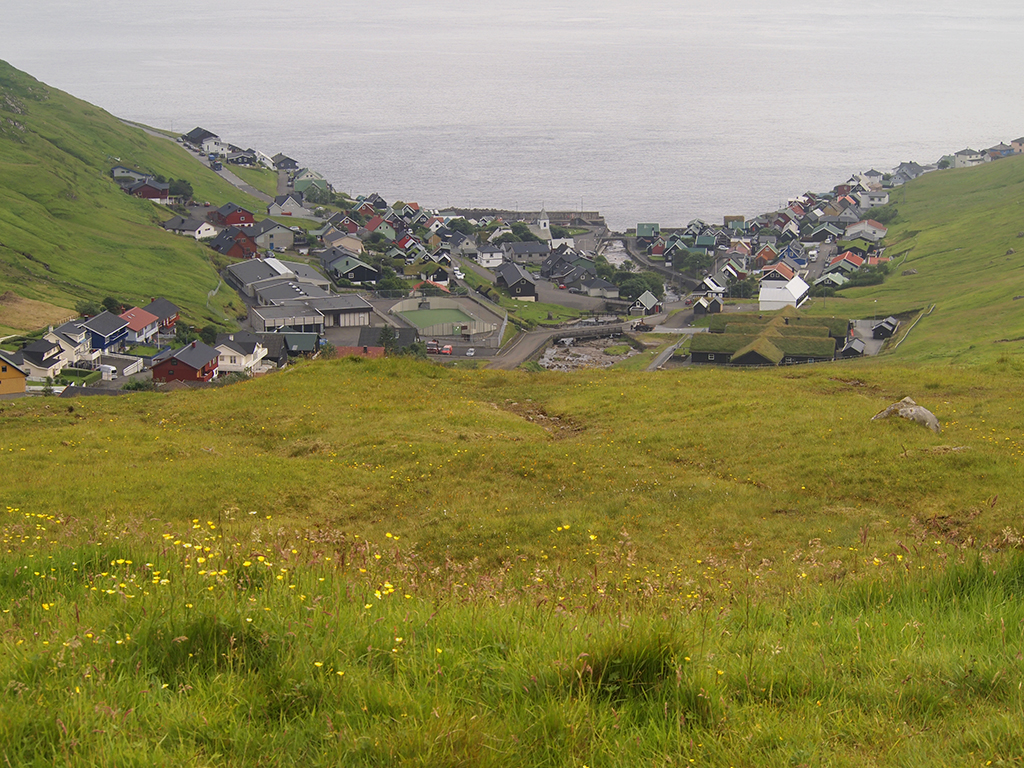
Nestled Village of Kvívik, Streymoy Island

Nestled Village of Kvívik, Streymoy Island

Houses are dwarfed by the landscape and appear like brightly colored dollhouses. Sheep graze everywhere, mostly running free on the impossibly steep elevations.  Fog rolled in and out of the undulating valleys. The ocean is always close at hand, sometimes far below as the road twists up, around, and over the landscape.

At Vestmanna, we boarded a fast motorboat, where I commandeered a corner seat at the back of the boat so I could take photographs. Although the sky was gray, the visibility was quite good. The trip took us out of the Vestmanna inlet away from the settlement and towards the open sea.

Vestmanna Settlement

Vestmanna Settlement

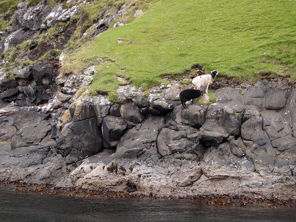
The seacliffs run across the entire end of the island, rising ever higher, dropping precipitously into the ocean. In a way, the heights reminded me of the Na Pali coast on the Hawaiian island of Kuauai. But these cliffs are rocky on the bottom half, with vertical grassy slopes on the top half, the ubiquitous sheep somehow managing to graze without tumbling into the sea.

Vestmanna Seacliffs, Faroe Islands
Vestmanna Seacliffs, Faroe Islands

Precarious Sheep

Precarious Sheep

The further along we traveled, the higher the cliffs rose from the sea. The sea had gouged out pocket caves into the rocks, with arches and stacks, and blue glacial water in tiny coves. There were bird nests everywhere, and a few white heads poking out, although most of the birds had already flown.
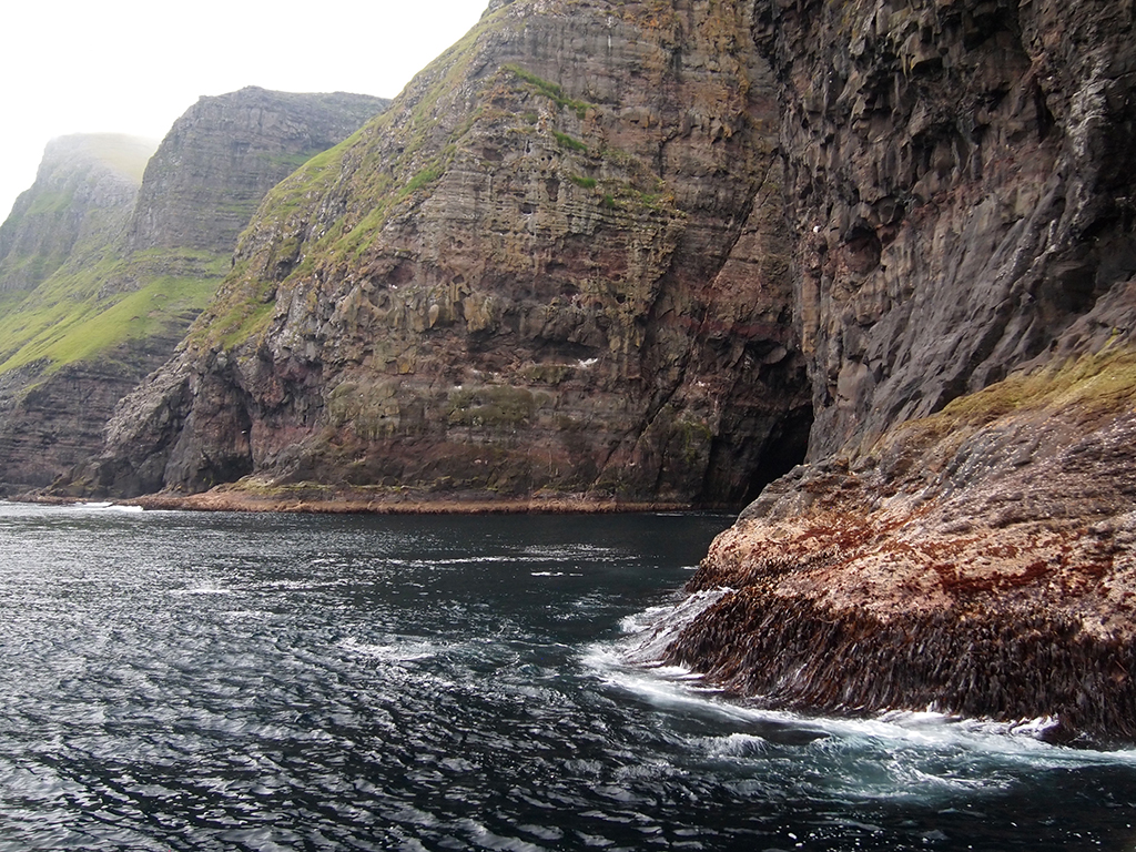
Carved Vestmanna Coast

Carved Vestmanna Coast

Nesting Seabirds

Nesting Seabirds

Altogether, the boat ride lasted about 2-1/2 hours. Oh the return trip, the captain turned up the power and raced us back to our starting point with a tremendous wake.
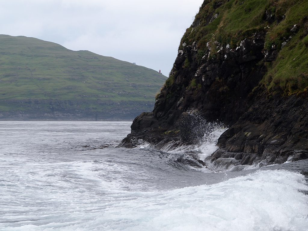
Tour Boat Wake on the Return Trip

Tour Boat Wake on the Return Trip

On the way back to Tórshavn, the bus driver and tour guide treated us to the old road over the mountain— in equally fine shape as the highway— so we could see more banks of fog rolling around the upper peaks, temporarily exposing various points of land jutting out of the mists. It is easy to see why the natives tell stories about strange little people who live in the mountains.
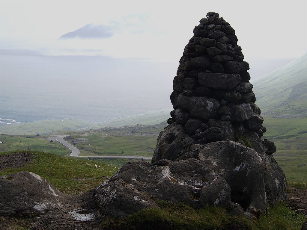
Old Stone Cairn on Streymoy Island
Old Stone Cairn on Streymoy Island

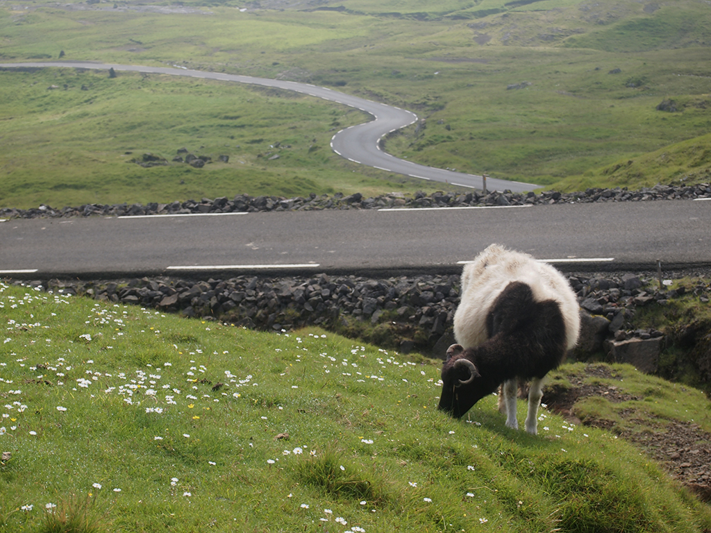
Unique Faroe Island Sheep

Unique Faroe Island Sheep

The Faroe Islands are about as remote as you can get, but they are truly fascinating, and I hope we can return some day.

P.J. Gardner

Proof That I was There (photo by a fellow passenger)

Photos © 2014 P.J. Gardner. All rights reserved.

Posted in Blog, Cruise | Comments Off on July 24: The Beautiful Faroe Islands

July 23: Seyðisfjörður, East Iceland

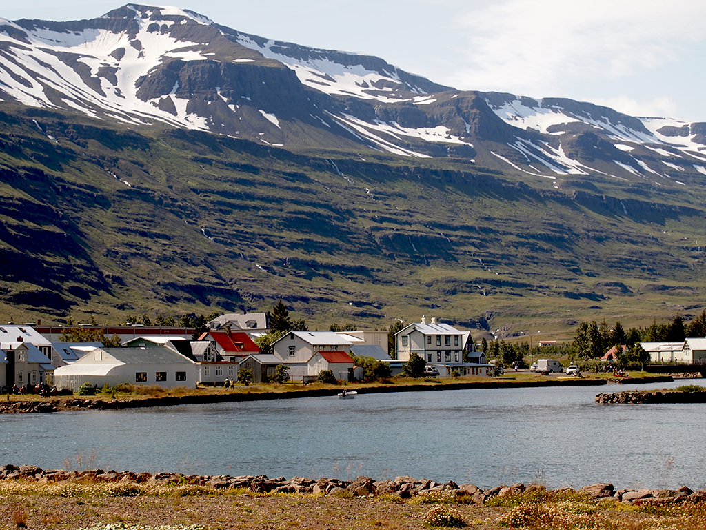
Seyðisfjörður, Iceland

Seyðisfjörður, Iceland

It was crystal clear and sunny when we entered the harbor of Seyðisfjörður, in East Iceland, this morning.  I had signed up for a tour described as a 75-minute bus ride with a hike to a waterfall at the end.  Because P.J does not walk that well, she chose to stay in town.

Veendam in Seyðisfjörður Harbor

Veendam in Seyðisfjörður Harbor

The bus ride went over a mountain pass.  There were wide open vistas, even more so because of the lack of trees, and waterfalls everywhere.  With the perfectly crystal clear weather, it was spectacular.  Our Icelandic guide told us that they had a lot of snow at the higher elevations this past winter, followed by a cold spring.  Therefore, there was still a lot of snowmelt from the mountains, and the waterfalls were rich with water.

Seyðisfjörður from the Pass (by Arjan Post)

Seyðisfjörður from the Pass (by Arjan Post)

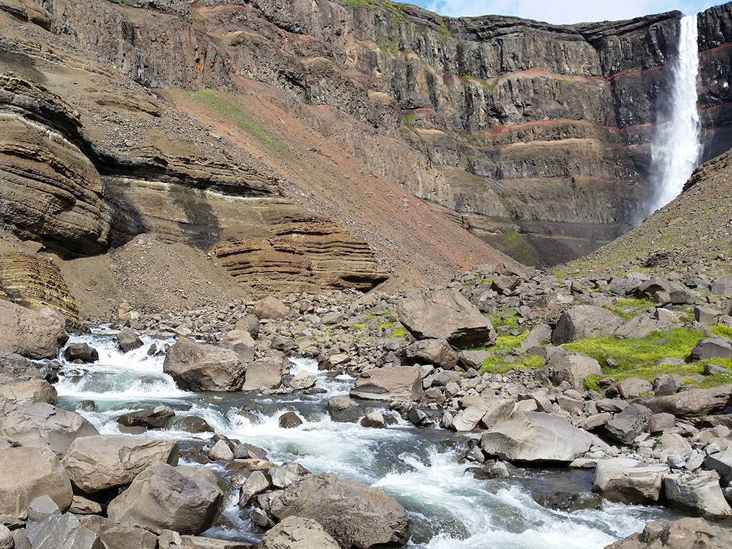
At the end of the bus ride, we parked at the start of the hiking trail to the Hengifoss waterfall.  They gave us two and a half hours to do it, each at our own pace.  I was able to keep a high enough pace to arrive at the falls before the crowd, in relative solitude.

Hike to Hengifoss (by Arjan Post)

Hike to Hengifoss (by Arjan Post)

Hengifoss Track (by Arjan Post)

Hengifoss Track (by Arjan Post)

On the way back I took a spur trail, and I was one of the last ones down, walking with the tour leader who was responsible for making sure everyone was off the mountain.

After the hike, one of the women approached a tour leader with an urgent tone of voice, “Please, do you have a cell phone I can borrow?”  After the tour leader replied she did not and inquired what the emergency was, the reply was, “I just did this hike, and I desperately need a spa treatment. I want to call the ship for an appointment.”

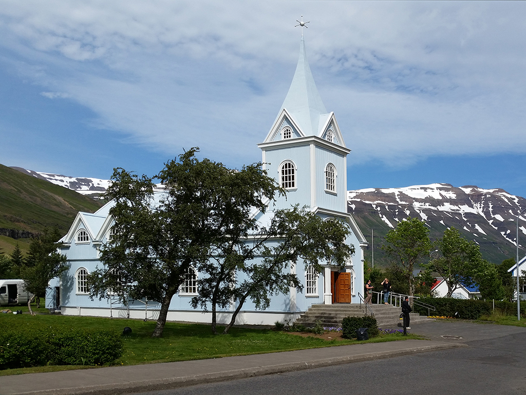
Little Blue Church in Seyðisfjörður (by Arjan Post)

Little Blue Church in Seyðisfjörður (by Arjan Post)

Back in the charming little town of Seyðisfjörður I took a walk through town, which is easy in a town of 700.  Seyðisfjörður, originally a fishing village like most Icelandic villages, is now mainly a tourist destination.  It has a drier climate than the rest of Iceland, because it lies in the rain shadow of the mountains to its west.

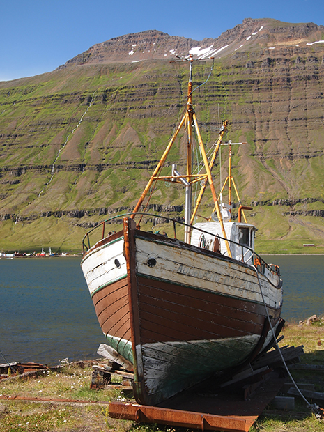
Derelict Fishing Boat, Seyðisfjörður

Derelict Fishing Boat, Seyðisfjörður

People from other parts of Iceland come here to vacation.  Seyðisfjörður has a car ferry to Denmark.  Many Europeans reach Iceland with their own cars this way, and then drive around the whole island on the famous “Route 1” that circles Iceland.

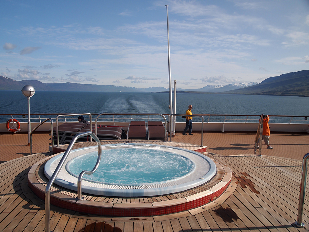
It was also remarkably mild.  This is the first time since Boston that I stood on the top deck in my shirt sleeves as we sailed out.  In short, today was my trip highlight so far.

Sailing Out of Seyðisfjörður

Sailing Out of Seyðisfjörður

Because of the slowness and expense of the Internet on board, we decided to upload our pictures after we arrive in Holland, on July 29.  We will then sprinkle our posts with the appropriate pictures.

Photos © 2014 P.J. Gardner & Arjan Post. All rights reserved.
Video © 2014 Arjan Post. All rights reserved.

Posted in Blog, Cruise | Comments Off on July 23: Seyðisfjörður, East Iceland

July 22: Akureyri, North Central Iceland

Akureyri, Iceland (by Arjan Post)

Akureyri, Iceland (by Arjan Post)

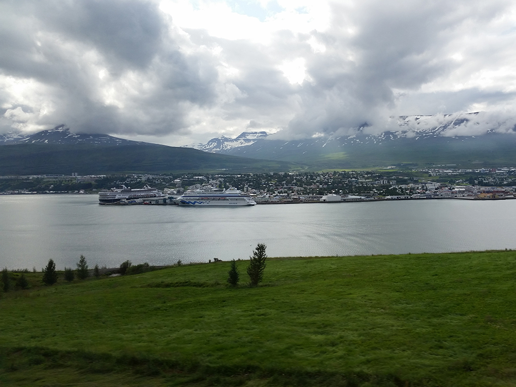
Our port of call, and starting point of our bus tour, was Akureyri, Iceland’s second biggest city of about 18,000.  In spite of being on the north coast close to the Arctic Circle, it has a fairly mild climate.

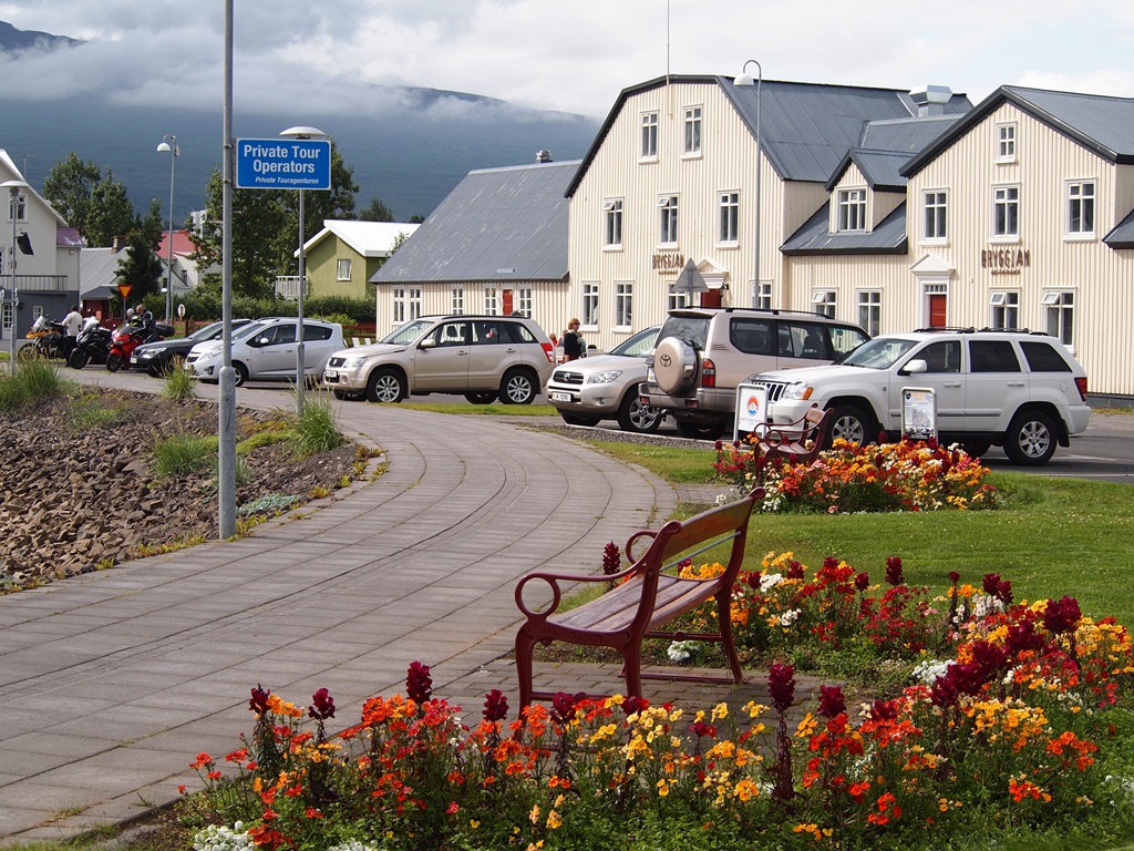
Akureyri Flowers

Akureyri Flowers

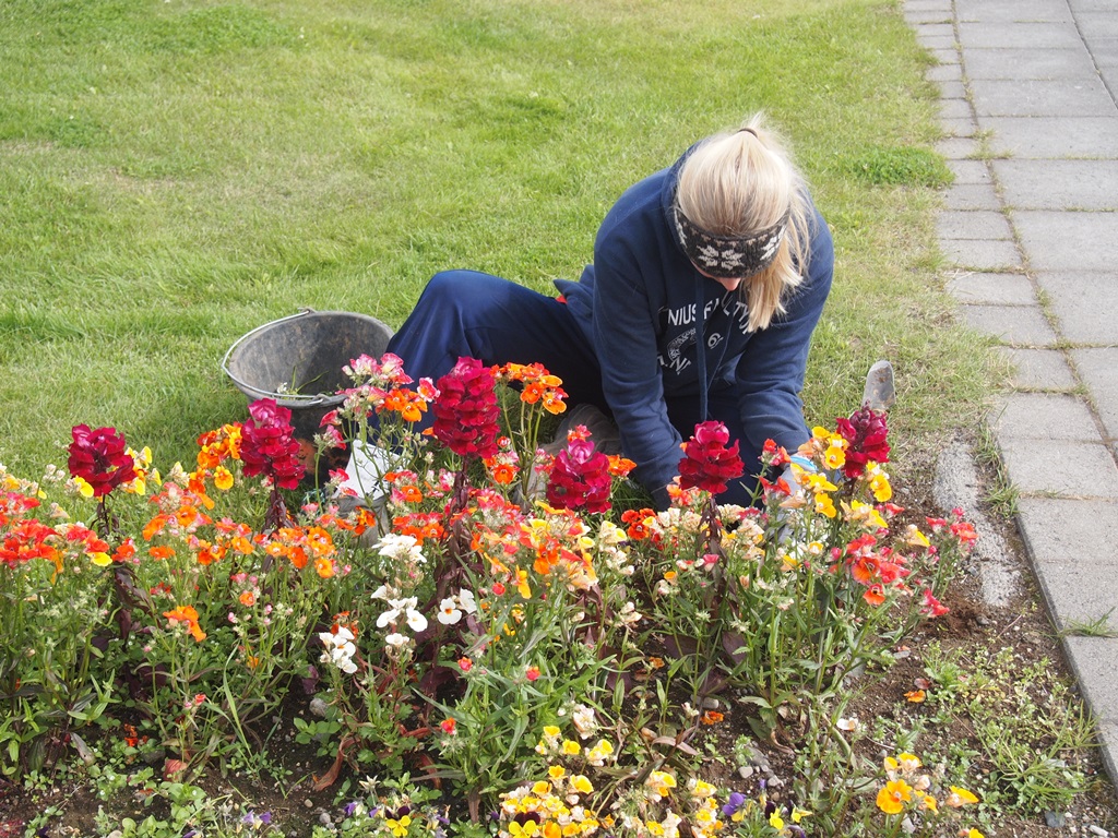
All Icelandic Youth Participate in Community Service

All Icelandic Youth Participate in Community Service

Today we were sheep.  The shepherd was a nice Icelandic lady, called a tour leader, who herded us into and out of busses.  I and my fellow sheep were allowed to spend a little time on our own here and there.  All kidding aside, given the allotted time and the distance, there was no other practical way to get a good look at inland Northern Iceland.

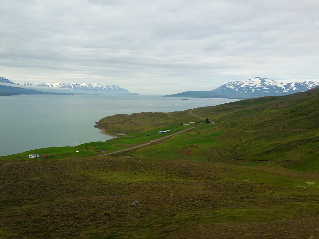
Eyjafjörður, Akureyri's Fjord (by Arjan Post)

Eyjafjörður, Akureyri’s Fjord (by Arjan Post)

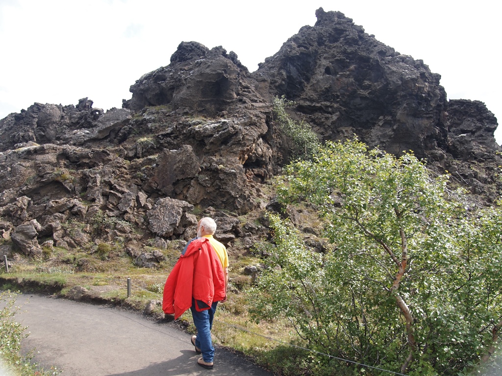
I did use my free time to take several short walks near Lake Mývatn and Godafoss falls.

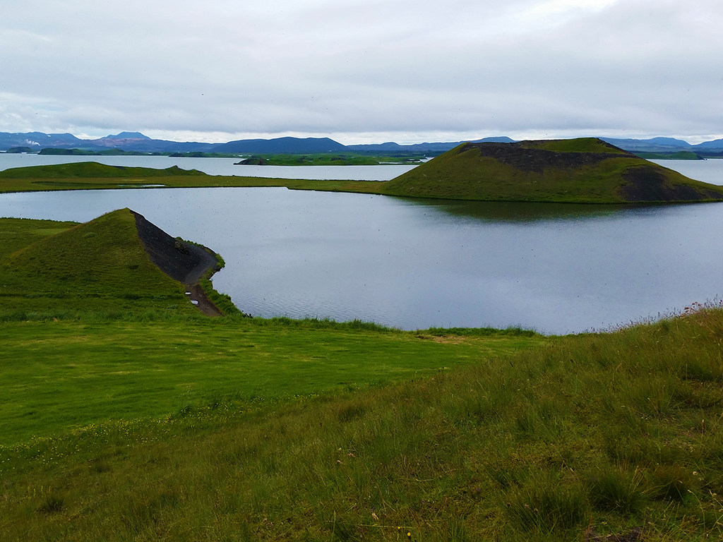
Lake Mývatn (by Arjan Post)

Lake Mývatn (by Arjan Post)

Lake Mývatn, we were told, is named after a fly that plagues the area, comparable to a sand-fly.  They weren’t kidding.  At one point I had to hold my hand in front of my nose and mouth because otherwise I might inhale whole clouds of them.  Insects, the scourge of the arctic!

Arjan  Walking in the Lava Labyrinth

Arjan Walking in the Lava Labyrinth

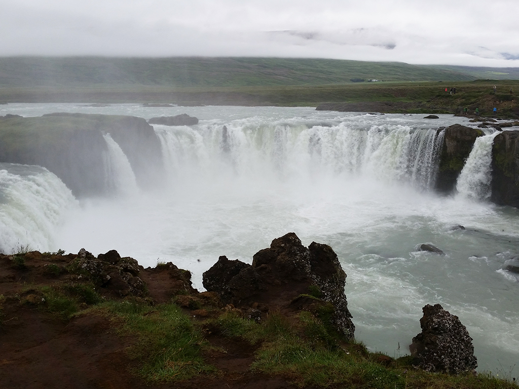
But at other places walking around was very pleasant.  Godafoss falls were definitely impressive.

Godafoss (by Arjan Post)

Godafoss (by Arjan Post)

Photos © 2014 P.J. Gardner & Arjan Post. All rights reserved.

Posted in Blog, Cruise | Comments Off on July 22: Akureyri, North Central Iceland

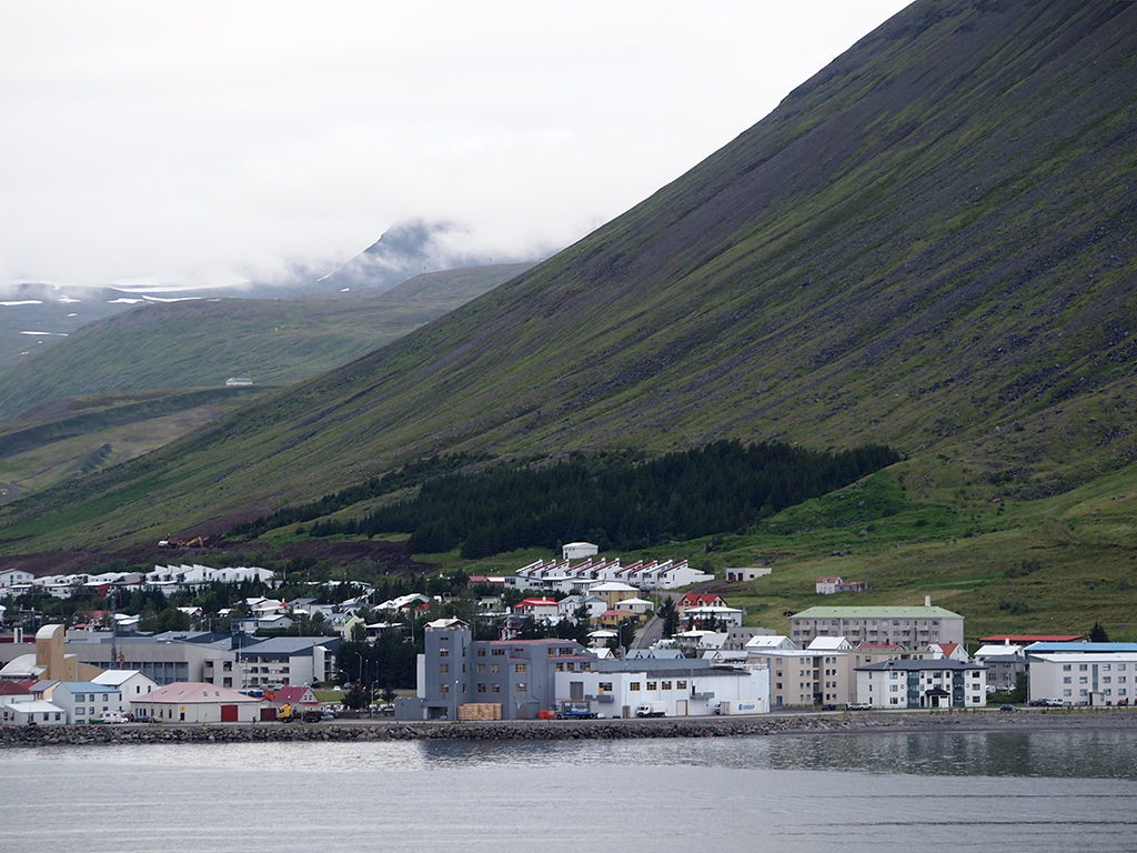
July 21: Ísafjörður, Northwest Iceland

Ísafjörður, Iceland

Ísafjörður, Iceland

Interesting, how we visited three remote locations so far, and they are all completely different.

In Labrador, we visited a tiny Canadian village with hardy souls, far removed from modern conveniences, with no cellphone service and very limited Internet service.  But they are basically modern people that choose to live in the wilderness.

Nanortalik, in Greenland, has a traditional Inuit culture, and as such is partly self-sufficient, but at a subsistence level.  Modern supplies are flown in by helicopter.

Ísafjörður, in Northwest Iceland, was originally founded on fishing and is also very remote.  But it has discovered tourism.  We saw a plane fly in and out, there were two cruise ships in port, there is excellent mobile and 3G service, and they take credit cards everywhere.

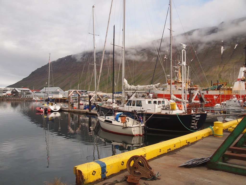
Ísafjörður Harbor, Iceland

Ísafjörður Harbor, Iceland

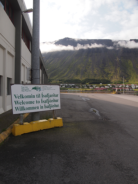
Welcome to Ísafjörður Sign

Welcome to Ísafjörður Sign

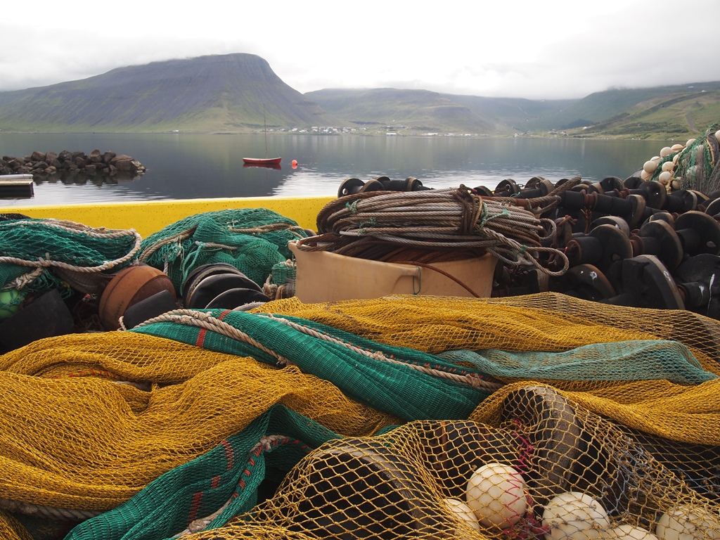
Fishing Nets at  the Westfjords Heritage Museum

Fishing Nets at the Westfjords Heritage Museum

Iceland resembles New Zealand in that it is sparsely populated (even more so than New Zealand), but it appears to have a thoroughly modern infrastructure.

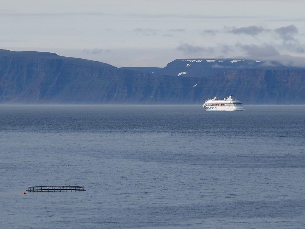
Two Cruise Ships in the Ísafjörður Fjord

Two Cruise Ships in the Ísafjörður Fjord

Between Greenland and Iceland we had a gale, and even after the wind subsided, it stayed gray and kept on raining.  We have not had a real sunny day since Corner Brook, Newfoundland.  When we sailed into Ísafjörður, it was still raining and miserable, but we were lucky again when we went on shore.  The rain stopped and later we even got some sunshine.

Sailing Out of Ísafjörður

Sailing Out of Ísafjörður

Right now, I am typing this blog entry while the ship is on its way to our next port.  From my window I have a magnificent view of Iceland’s northwest coast: fjords, surrounded by high table mountains, as if plucked out of the American west, but rising straight out of the North Atlantic.  It is 10:40 in the evening, and the sun is shining.  We are crossing the Arctic Circle.

Photos © 2014 P.J. Gardner. All rights reserved.

Posted in Blog, Cruise | Comments Off on July 21: Ísafjörður, Northwest Iceland

July 20: Stormy Night

Last night was stormy.  The Denmark Strait, east of Greenland, often has this kind of weather.  The captain said that we experienced a northeasterly gale, force 8, but our TV display of current conditions briefly registered gale force 9 and even 10.  The temperature was 39 F (4 C).  Towards the morning the storm subsided, temperature went up to above 50 F (10 C), and conditions continue to improve today.

P.J hadn’t taken her seasickness medicine and she did not feel well, but she did not actually get sick.  I slept better this morning, the rocking motion made me sleep till 8, although I was awake for an hour during the height of the storm when doors were rattling, walls were creaking, and the ship shuddered occasionally when hitting a big wave head on.

Posted in Blog, Cruise | Comments Off on July 20: Stormy Night

July 19: Nanortalik, Greenland
(Autonomous region of Denmark)

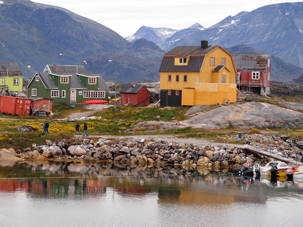
Colorful Houses in Nanortalik, Greenland

Colorful Houses in Nanortalik, Greenland

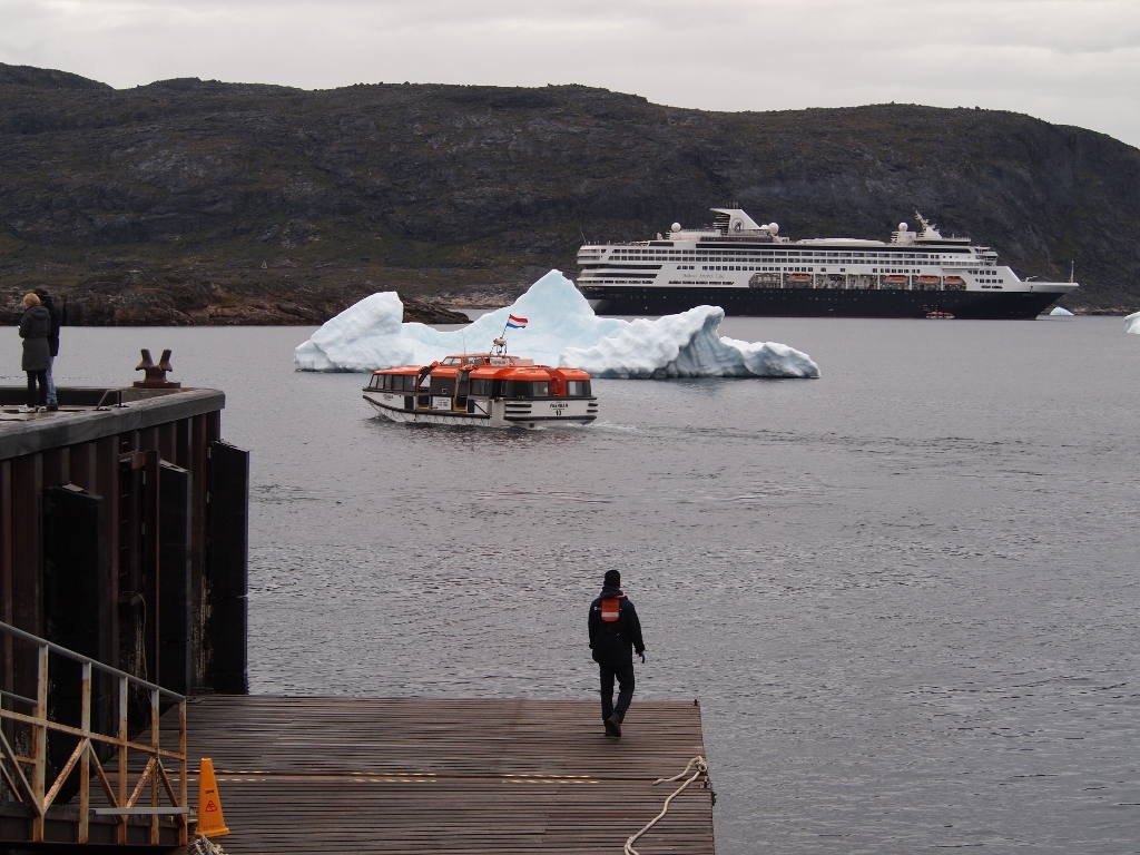
We had to rise early to catch the 7:30 AM “lifeboat” to town.  We could only stay till 1 PM, because the captain was expecting a head current, a headwind, and lots of icebergs on our way to our next destination, Ísafjörður, in northern Iceland, and we are on a tight schedule to make that by noon on Monday.

Tender, Iceberg and the Veendam

Tender, Iceberg and the Veendam

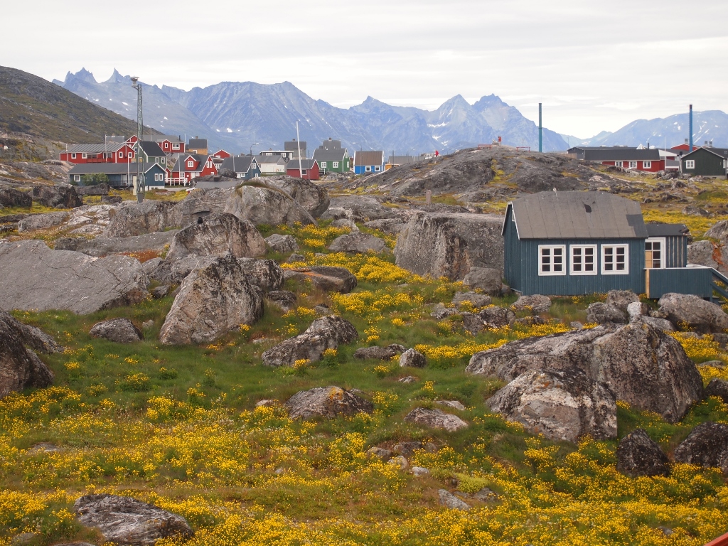
The scenery is magnificent, sharp craggy mountains rising up in the distance, scattered icebergs all over the harbor.

Craggy Mountains and Wildflowers in Nanortalik

Craggy Mountains and Wildflowers in Nanortalik

While walking through town, we heard something like a loud thunderclap.  I looked around to see a large chunk break off one of the larger icebergs at the entrance to the harbor.  It generated a big wave that rocked our ship.  It looked like it might also make our ship’s exit more challenging.  And indeed, the captain decided to gently maneuver our vessel around the iceberg, so we would no longer be blocked by it.  So even when you think that the “coast is clear”, around here that may change in an instant, and a 57,000 ton cruise ship is still no match for an iceberg.

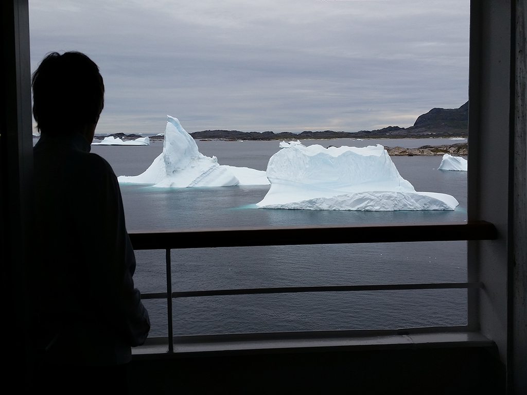
Icebergs in Nanortalik Harbor (by Arjan Post)

Icebergs in Nanortalik Harbor (by Arjan Post)

We went to an open-air museum.  The entrance fee was $10 US, 5 Euro, or 25 Danish Kroner.  The cruise line recommended getting some Danish pocket money.  I got 200 Danish Kroner for $40 US.  So, P.J. and I got in for $5 US each.  Nevertheless, I saw a couple turning around and heard them griping about having to pay so much in US money.  Apparently, some folks expect the almighty buck should be worshipped everywhere.

Open-Air Museum at Nanortalik (by Arjan Post)

Open-Air Museum at Nanortalik (by Arjan Post)

The museum was well done and interesting to me because I became immersed in what subsistence living in Greenland means.  We were forewarned that the Inuit (formerly known as Eskimos, the original Greenland natives) still hunt seals and whales.  This might offend our politically correct sensibilities.  There were pictures of people celebrating when a dead whale was towed into town, and then enjoying an exquisite whale blubber meal.  There were whale blubber barrels, and sealskin pockets in which to cure whale blubber.

I cannot be offended by people who have lived this way for thousands of years.  I do not need whales to survive, and I am not intrigued to try whale blubber for lunch.   What made whaling offensive is industrial-scale greed.  Same as with the industrial-scale fishing on the Grand Banks, off the coast of Newfoundland.  There are accounts from hundreds of years ago, that you could simply dip a bucket in the water to get fish.  Now the Grand Banks have been totally depleted, and for now, beyond stock restoration.

The weather continues to be mostly cloudy and a cool 38 F (3 C) in the morning. Later it went up to 46 F (8 C).  But there was no rain and not much wind while we were on shore.  It was pleasant to walk around.  My smartphone picked up a 3G signal and informed me that it was 95 F (35 C) in Rotterdam at the moment.

Towering Icebergs in Nanortalik Harbor

Towering Icebergs in Nanortalik Harbor

Photos © 2014 P.J. Gardner & Arjan Post. All rights reserved.

Posted in Blog, Cruise | Comments Off on July 19: Nanortalik, Greenland
(Autonomous region of Denmark)

July 18: Life at Sea

Daily Reminders in the Elevator

Daily Reminders in the Elevator

Life at sea, when there are no excursions, is not super exciting.  P.J and I have established a pattern.  Today, I was awakened at 6:30 AM by the hustle and bustle in the restaurant above our cabin.  By 7:30 I was at breakfast.  P.J stayed in bed because she worked on a jigsaw puzzle until 2 AM.  Later in the morning we typically go to the theater to attend presentations about our upcoming destinations.  There is also a historian who is a very good and entertaining lecturer.  In the afternoon I go for a walk outside, get on the net to upload the blog and download my email, and to read the New York Times on-line (which is a free site); P.J does puzzling in the Explorer lounge.

P.J.'s Favorite Place on the Ship

P.J.’s Favorite Place on the Ship

We have dinner with fellow travelers.  I usually turn in by 10:30 or 11, while P.J often goes to the ship’s evening entertainment, which I generally skip— except last night when they had a Canadian duo, Bande Artistique, that used to be in Cirque du Soleil.  They were quite original and very entertaining.

There are many “professional cruisers” on board, elderly people who hardly spend time at home and go from one cruise to another.  If you have the money, it beats sitting in an old age home.  They take much better care of you and you interact with fewer demented and more younger people (but not too much younger).  We heard a second hand story of one woman on board who stays on the ship wherever it goes.  When her ship had to go into dry-dock for renovations, she did not know what to do or where to go.

It is gray today, about 50F/10C, but quiet and no rain or fog; the ocean is very placid.  We are getting pretty far north.  The sun rises around 4:30 AM and sets around 10 PM.  This morning there was an Orca sighting.  A pod of Orcas was jumping very close to the ship.

Tomorrow we have a 7:25 AM tender appointment to get off the ship at Nanortalik, Greenland.

Photos © 2014 P.J. Gardner. All rights reserved.
Posted in Blog, Cruise | Comments Off on July 18: Life at Sea

July 17: No Cartwright— Instead Icebergs and Fog

After returning to the ship at Red Bay, Captain van der Wal informed us that we would not be going to Cartwright (in Labrador, north of Red Bay) where we were scheduled to be today.  I was looking forward to getting a peek at Labrador even further north, but apparently this year there is an abundance of icebergs and that, combined with a poor weather forecast, made it difficult to go on-shore with the tenders.

Apparently, a change of itinerary is not unusual, especially on this northerly cruise, and for ports of call without a cruise terminal, when you must depend on decent weather for the tenders.  Last year, the visit to Nanortalik (Greenland)— our next destination— had to be canceled due to icebergs.  As of now, Nanortalik looks good, but that can still change.  All the destinations after Greenland have cruise terminals, so we are not likely to miss those.

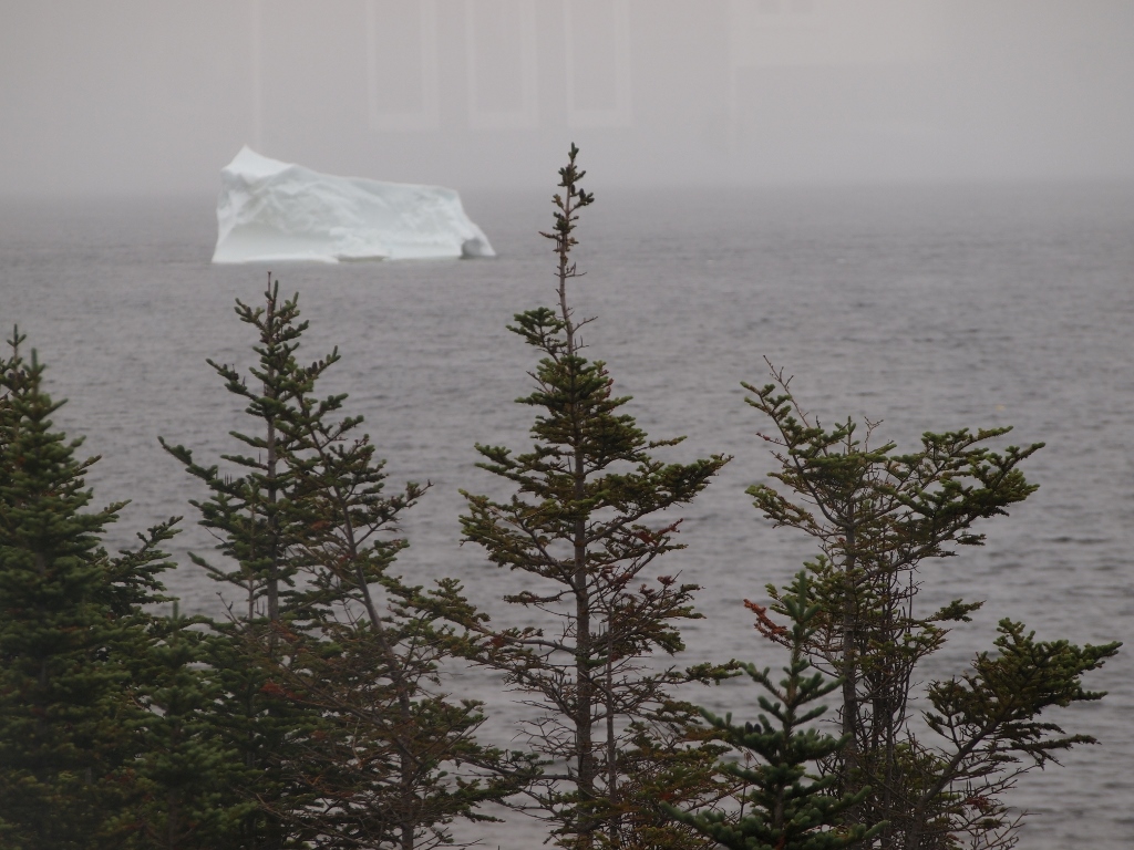
First Iceberg Sighting at Red Bay

First Iceberg Sighting at Red Bay

As we sailed out of Red Bay we saw several icebergs.  One we could see from afar looked more like an ice island.  The ship steered well clear of it.  While navigating between icebergs, our ship went into a dense fogbank.  I appreciated the navigation skills of our crew.  Fortunately, the technology is a lot better than in the days of the Titanic.

The ship initially followed a more easterly course to clear “Iceberg Ally” (a.k.a. the Labrador Current) as quickly as possible.  We did that around 10 AM this morning, and then we turned more north towards Nanortalik, where we are scheduled to arrive Saturday morning.

Photo © 2014 P.J. Gardner. All rights reserved.
Posted in Blog, Cruise | Comments Off on July 17: No Cartwright— Instead Icebergs and Fog