Featured

50 Miles Per Gallon!

Welcome to Arjan and P.J.’s 2012 travel blog. [Well, maybe we actually got 49 miles to the gallon, but you get the idea.]

We embarked on a cross-country trip during the months of August and September 2012 in our red Prius. This blog shares about our happenings along the way. We started out on August 1, returned home on October 2, and reported our progress as we went.

We made a blog entry almost every day of our trip. Arjan usually did the writing, and P.J. added the pictures.

Our trip has ended. That’s why our Prius points at Massachusetts. During the trip, we moved the car icon on the map above to show our progress. Now the Prius is back home.

An important part of the journey for P.J. was taking modern photographs that match her Aunt Esther’s vintage postcards. There are now links to Aunt Esther’s Vintage Postcards blog at the bottom of any page with matching photographs.

Latest Updates

We returned home to Massachusetts on October 2, a little tired of traveling, but thrilled to have had such a wonderful adventure. During October that fall, we also took two more quick trips: to Vermont for a week, and back to California for Arjan’s father’s birthday.

There are still some photos missing: our Alaskan cruise (August 12 through August 18); Mount Rainier (August 20 & August 21); Oregon Coast (August 28 & August 29); Redwoods (August 30); Grand Canyon (September 12 & 13); Yellowstone (September 23 & 24); Black Hills and Badlands of South Dakota (September 27 & 28); and lots more vintage postcards from Great Aunt Esther (now in a blog of its own).

This may sound like a lot still left to do, but there are over 300 photos that made it into the two blogs! Enjoy!

Be sure to review “Older Posts” to see anything you may have missed!

October 2: Home Again and Epilog

Mile 12,631 – Home Again.  Our last day, we drove home from Austin, Pennsylvania.  It was only the third day (out of 63) without any sunshine.  The weather was dreary and drizzly when we arrived.

Those of you who have been following the blog regularly may have read some of my sneering comments about other tourists and tourist traps.  The overpriced hoopla and interminable “commutes” in-and-out of Yellowstone and Grand Canyon National Parks are not the fault of the Park Service.  The truth is that the most popular attractions suffer from their own popularity.  Providing more services and accommodations will only make things worse. 

Some of my more memorable experiences were often spontaneous surprises in not-so-famous places:

  • Taking a swim in a lake in Northern Minnesota
  • The Grand Coulee landscape in Washington state
  • The kite festival in Long Beach, Washington
  • Driving down an abandoned stretch of old Route 66 in Arizona
  • Hiking the Pancake trail near Pikes Peak with my friend Johanne
  • And a silly afternoon with P.J.’s sister Wendy and brother-in-law, near the Kinzua Dam

We threw apple cores into the Allegheny River and, to our surprise, the cores got caught in eddies and started floating up-stream until they got caught in the rapids.  Watching that process was a pleasantly mesmerizing, relaxing, and educational activity (in hydrodynamics) on a beautiful day in the beautiful Pennsylvania Wilds.

On my next cross-country trip, which will not be any time soon, I’d like to spend more time visiting not-so-famous places and places I have not been before.  I also want to plan a destination trip to Yellowstone, with accommodations inside the park.  That park may be crowded, but it is also big enough so you can escape the crowds if you are willing to walk.  And it has such a variety of sights to see!

This concludes my daily posts.  I have updated the highlights and lowlights with trip summary entries, and P.J. still has more pictures to upload.  We hope to have the blog complete soon.

October 1: Sightseeing in Pennsylvania

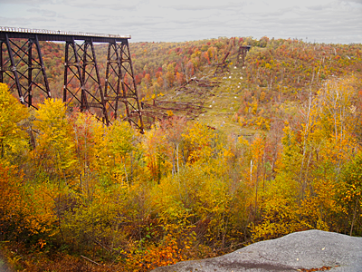
Kinzua Bridge
Kinzua Bridge (Tornado Damaged in 2003)

Mile 12,170 (we were driven around).  Today we went out sightseeing and were driven around for a change.  We went to the Kinzua Bridge, a railroad viaduct orginally built in the late 1890’s— at the time the highest bridge in the world.  Regular use was abandoned in 1959, and it was made into a tourist train attraction.  In 2003, a tornado tore down part of the bridge and now the part that is still standing ends in an observation platform with a glass floor.  We also went to the Kinzua Dam and Reservoir in the Allegheny River.

We saw no foreign tourists, and it was not overcrowded.  Sometimes, lesser-known attractions closer to home are just as enjoyable and allow for more serene pleasures.

Kinzua Dam
Kinzua Dam
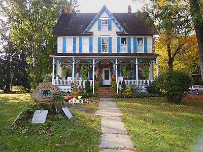
First Fork Lodge
First Fork Lodge, Austin, Pennsylvania (our lodging)
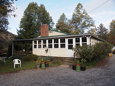
Wendy and Al's House
Wendy and Al’s House (Austin, Pennsylvania)
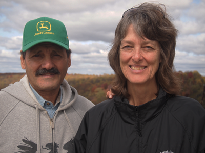
Wendy and Al
Sister Wendy and Husband Al

[Photographs © 2012 P.J. Gardner. All Rights Reserved.]

September 30: To Austin, Pennsylvania

Foliage in Pennsylvania
Emporium, Pennsylvania

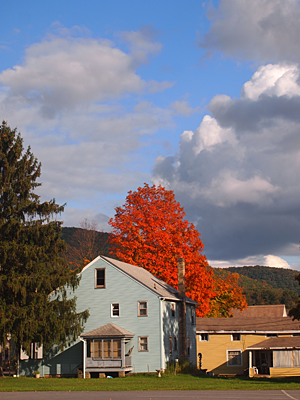
Mile 12,167 – Austin, PA.  Back in the Appalachian mountains.  A driving day where the scenery was enhanced by cloudscapes with towering cumulus and cumulonimbus clouds.  We had a downpour immediately followed by the most gorgeous, clear late-day sunshine.  The foliage here in Potter County, in north central Pennsylvania, has started but not peaked yet.  The countryside looks fresh and dust-free.

October 1, we’ll be spending with P.J.’s sister Wendy and her husband, Al.  Tuesday, we drive home.

[Photograph © 2012 P.J. Gardner. All Rights Reserved.]

September 29: Crossing the Mississippi

Crossing the Mississippi
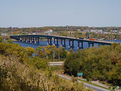
Crossing the Mississippi on I-80

Mile 11,755 – Fremont, Indiana (in the extreme northeast corner of the state). There are good things about returning home.  The weather, especially late today after we passed Chicago, was exceptionally clear.  The trees and countryside in Indiana looked lush after the parched grasslands of South Dakota and the dusty farmland of Iowa.

It appears in Iowa they don’t seal their gravel roads with something that inhibits dust.  The countryside was filled with dust clouds, sometimes kicked up by a single car.  When I pumped gas this morning, I found the outside crevasses of my car filled with a tan-colored dirt.  When I tried to wipe it with my finger, my finger became greasy black.  It is either Iowa dust or smoke soot from the West.  We breathed that stuff?  I will forego the chemical analysis.  I am tired of the smoke and dust.  I am glad to be back in the lush vegetation and relatively clear air of the East.  Who would have thought that?

We may not have Internet access our last two nights in Austin, Pennsylvania.  So we’ll complete the blog after we get home on Tuesday.

[Photograph © 2012 P.J. Gardner. All Rights Reserved.]

September 28: To Waterloo, Iowa

Wall Drug
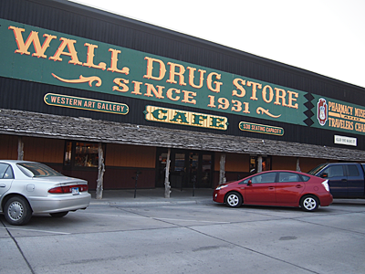
Famous Wall Drug

Mile 11,291 – Waterloo, Iowa. Since we spent the night in Wall, South Dakota, P.J. made the obligatory photograph of Wall Drugs (before they opened!). We spent another quick hour in the Badlands, and then it was drive, drive, drive, all day long.  The landscape gradually changed from dry grassland to dry farmland.  Politics does make a difference: in South Dakota we saw no windfarms— in Minnesota, they are ubiquitous.

Badlands National Park Sign
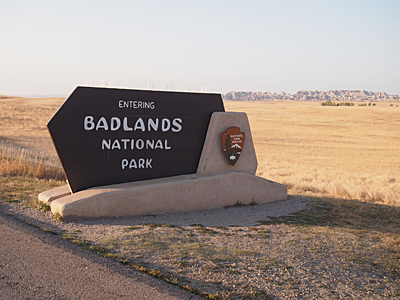
Badlands National Park
Cedar Pass in Badlands National Park
View from Cedar Pass in the Badlands

[Photographs © 2012 P.J. Gardner. All Rights Reserved.]

September 27: Fall Colors in South Dakota

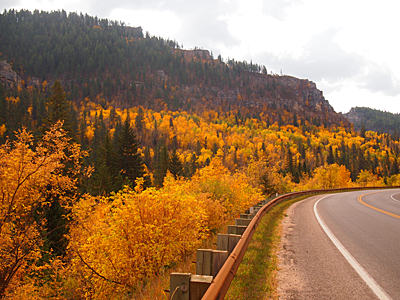
Spearfish Canyon
Fall Foliage in Spearfish Canyon

Mile 10,677 – Wall, South Dakota. New Englanders tend to turn up their noses at fall colors elsewhere.  This morning, we drove through Spearfish Canyon, in the Black Hills of South Dakota.  Colors were at peak, and it was absolutely gorgeous.  We did not expect this, but it was one of the highlights of the day.  The other one was driving through Badlands National Park.

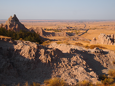
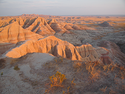
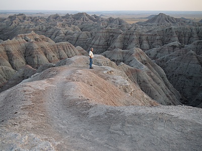
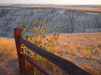
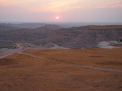
We are running out of time on our trip and we crammed in a lot the last day, so we arrived in the Badlands in the late afternoon and stayed until sunset.  The Badlands are stark and peaceful.  It was kind of poignant: the last major attraction of our trip in the setting sun. 

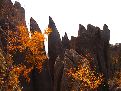
Earlier we drove down the Needles Highway, in Custer State Park.  P.J.’s Aunt Esther left a pile of postcards of that 11-mile drive, and it was difficult to match them all in the time we had.  But the highway is definitely unique and worth a visit: two-billion-year-old, hard volcanic rocks (many “needle-like”) that were exposed after the surrounding soil eroded away over the eons.

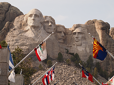
After the Needles Highway, we went to Mount Rushmore— we had to because P.J had never been there and Aunt Esther left post cards.  When I was last there, I remember loudspeakers blaring with either patriotic music or propaganda, completely ruining any sort of experience for me.  Now the memorial has been renovated (1998).  The loudspeakers are gone, definitely an improvement.   But instead, there is an airport-style parking system that charges $11. National Park passes are not honored because it is a private concession.  Our Mount Rushmore parking pass we bought today is valid until the end of the year!  I’ll just have to fly back a couple of times to get my money’s worth (actually P.J. paid for it).  From what I’ve read about George Washington, he might have disapproved of all that “royal treatment” in his honor.

Needles Pinnacles
Needles Highway, Custer State Park
Four Presidents at Mount Rushmore
Badlands Afternoon
Badlands in Afternoon Glow
Arjan in the Badlands
Badlands Bighorn Sheep
Bighorn Ram in the Badlands
Flowers in the Badlands
Badlands Sunset
Badlands Sunset

Vintage Postcard Project: September 27: Mount Rushmore, South Dakota

[Photographs © 2012 P.J. Gardner. All Rights Reserved.]

September 26: Big Horn Mountains and Devils Tower

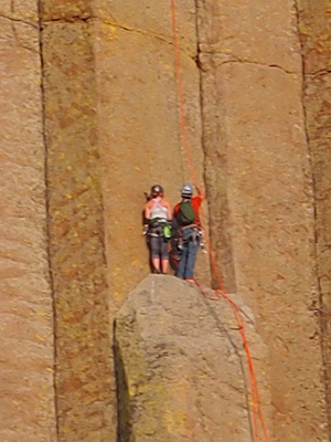
Devils Tower Climbers

Mile 10,408 – Sundance, Eastern Wyoming.

Once Upon a Time, man invented the [New England] hiking trail, narrow with lots of rocks and challenging obstacles.  Then man moved West, where there’s more space, and man invented the wider, smoother hiking trail.  Then hiking trails needed to be made accessible, and they were paved, and man saw that it was good.  Today, I walked around the Devils Tower in Wyoming and discovered another incremental jump in hiking technology— paved hiking trails with speed bumps (for bicycles)!  I can’t wait for hiking trails with traffic lights and interchanges!

All kidding aside, Devils Tower (remember Close Encounters of the Third Kind?) was interesting and impressive.  We walked around its perimeter, at the base.  Watching others climb the tower was an enjoyable spectator sport.

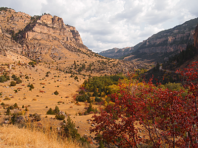
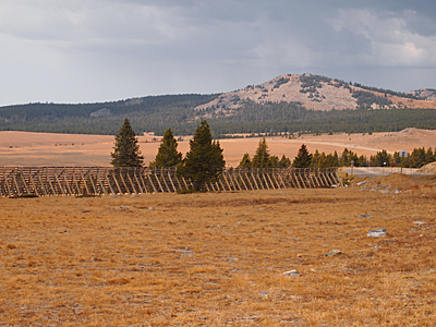
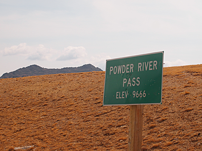
Earlier today, we drove across the Big Horn Mountains, an unusual mountain chain.  The southern end (Cloud Peak Wilderness) is essentially a plateau that was pushed up above the surrounding countryside.  The oldest rocks are on top.  There are no towering peaks like the Grand Tetons along the plateau, but there are deep canyons where roads wind up and down to the high plateau. Powder River Pass, at 9666 feet, was the second highest elevation of our trip (after Wolf Creek Pass).

Before we leave Wyoming: my compliments about the Rest Areas maintained by the state of Wyoming.  They are not only on Interstates but also on the long, endless highways and byways, and they often have informative geological, cultural, and historical displays.

Bighorn Canyon Entrance
Big Horn Canyon Entrance
Bighorn High Plateau
Big Horn High Plateau
Powder River Pass
Powder River Pass in the Big Horn Wilderness

Vintage Postcard Project: September 26: Devils Tower, Wyoming

[Photographs © 2012 P.J. Gardner. All Rights Reserved.]

September 25: From Yellowstone to Buffalo Bill

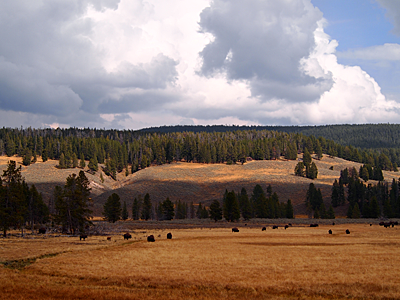
Bison Herd
Bison Herd in Hayden Valley

Mile 10,066 – Cody, Wyoming.  Until now we’ve had fabulous luck with weather, but the last three days in Yellowstone our luck ran out.  Today started with rain and smoke, then some sun and clouds, and later more rain.  Once we left Yellowstone, skies cleared on our way to Cody, which is in Yellowstone’s rainshadow.

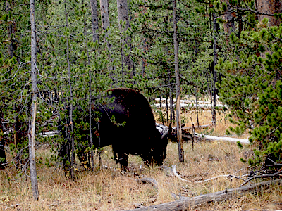
Because of the weather, we spent most of the day in visitor centers, but we also spent time at Hayden Valley where the buffalo roam.  One of the highlights was a bison standing in the middle of the road, blocking traffic.  After a while he decided asphalt is not very nutritious, and people staring at him from those funny glass and metal boxes was annoying, and he moved on.

I want to come back to Yellowstone in the future as a destination and plan it better, and also hope for better weather.

Bison at Side of Road
Bison After Blocking Traffic
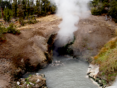
Dragon's Mouth Geyser
Dragon’s Mouth Geyser
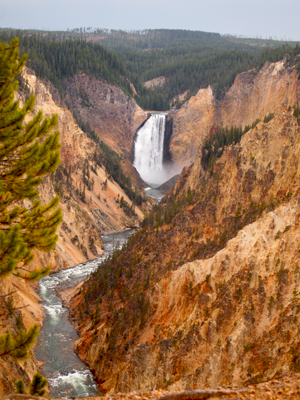
Yellowstone Lower Falls from Artist's Point
Yellowstone Lower Falls from Artist’s Point
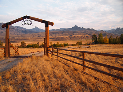
Wyoming Ranch
Wyoming Ranch Near Buffalo Bill Reservoir

[Photographs © 2012 P.J. Gardner. All Rights Reserved.]

September 24: Yellowstone, Day 2

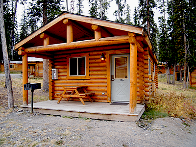
Our Cabin at Togwotee Mountain Lodge
Our Cabin at Togwotee Mountain Lodge in Moran, Wyoming

Mile 9864 – Still in Moran, Wyoming (“local” miles only).  Imagine if you wanted to visit Connecticut but under one condition: You cannot stay in the state, you must stay outside the state and commute in-and-out every day.  That’s what it is like if you don’t have reservations in Yellowstone.  That’s why it is a little too challenging to see everything we wanted in three days. 

When we departed this morning, there was dense smoke again in Grand Teton, near where we are staying.  But in Yellowstone, it was pleasantly sunny.  In the late afternoon, the rain started and the smoke almost disappeared.

Nevertheless we had a good day.  The rain held off till 5 PM and the park has so much varied scenery and wildlife to offer, not just geysers.  Just wish we could stay longer and in a better location.

My advice to potential Yellowstone travelers:  Plan a year in advance. With an RV or a tent, you are more likely to stay in the park, but in the summer even that may not work out.

Vintage Postcard Project: September 24: More Yellowstone National Park

[Photograph © 2012 P.J. Gardner. All Rights Reserved.]